Loading...
South America 1950 Relief Map
$79.00South America 1950 Relief Map
$79.00Sign In to Continue
×You must be signed in as a media user to and interact with hundreds of media-ready brands.
Create your Media account
×Welcome Back!
×Request Samples
Please fill out the following information:
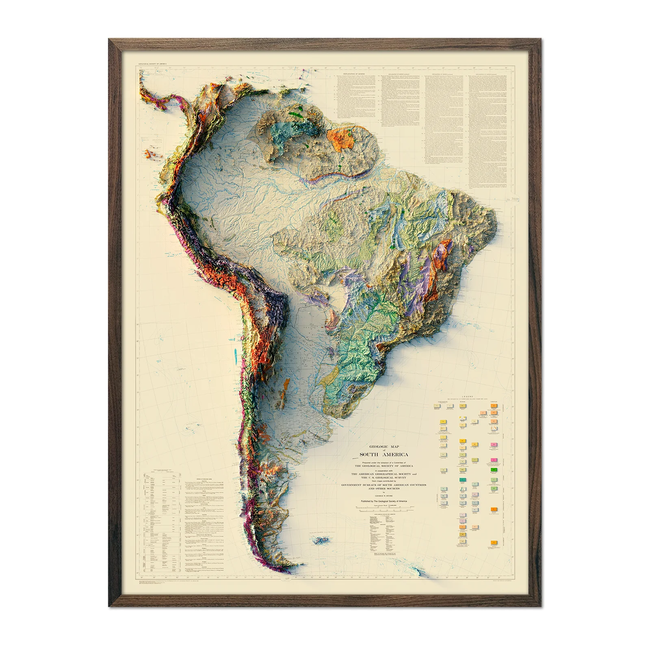
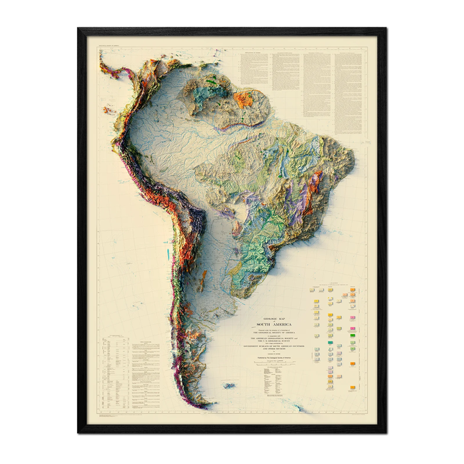
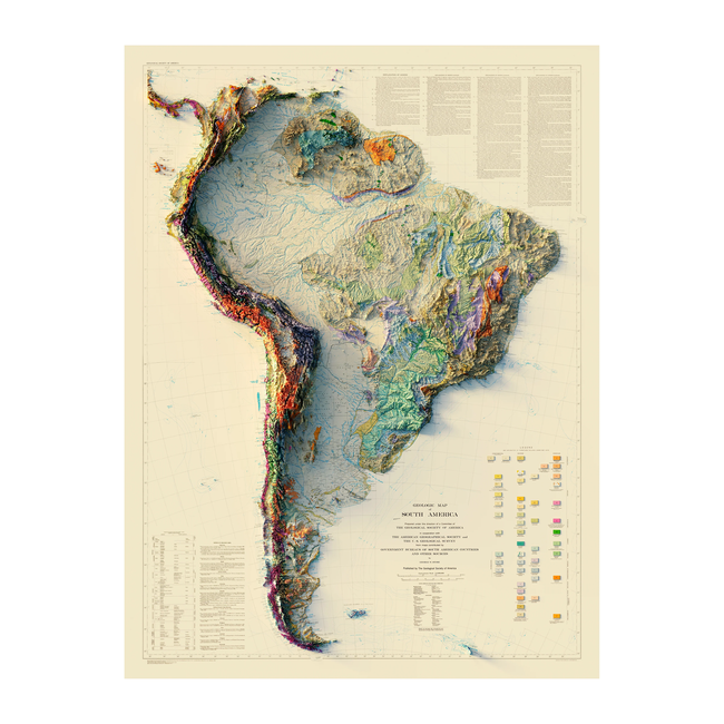
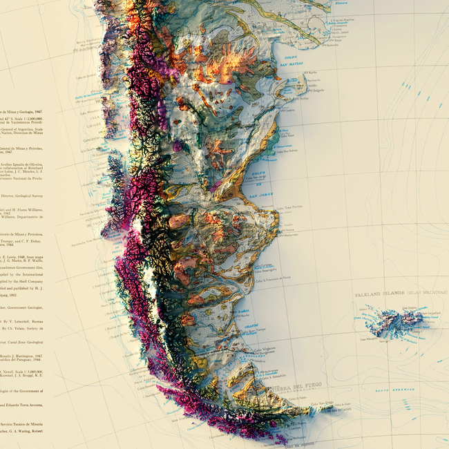
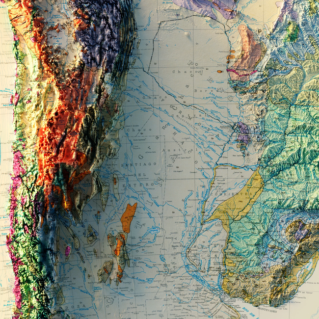
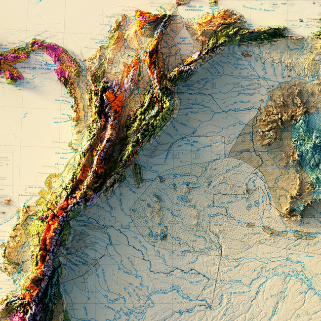
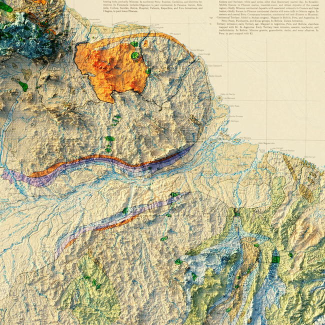
We created this map with the illusion of 3D by applying Digital Elevation Data and meticulously adding shaded relief to the landscape of the original geologic 1950 South America map. The shading is printed on the paper and not a result of the map protruding from the surface.
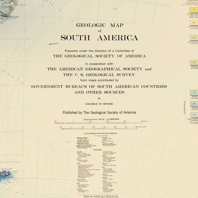
Please Note: Text on the map can be difficult to read due to the small font size and the age of the map. In areas where the relief shading covers the text, the underlying text is not legible. We suggest the largest size map for better details though the text may still be covered in the darker areas.
Details
Here are some specific details about the South America 1950 Relief Map:
- Sizes: Available in 18x24 Inch, 24x32 Inch, 30x40 Inch, and 44x58 Inch.
- Colors: The map features amazing colors produced using premium archival inks.
- Frames: Options include no frame, black frame, and walnut frame.
At Muir Way, we believe in providing the utmost quality, design, and value.
- Unsurpassed archival materials and printing
- Over 4500 5-star reviews
- 30-day returns*
- Individually printed in our San Diego workshop


